
Route 66 is not the first, nor the longest historic interstate highway in America, yet it's easily the most famous due to its iconic small towns and gas stations, road trip views and landmarks such as the Grand Canyon. Despite its fame, few might reliably tell you the terminal points of the road.
Unlike the Interstate highways, which had exits numbered from west to east or south to north, US highways don't have labelled stops until they terminate. So, where does Route 66 start and end?
Chicago, Illinois
Route 66 began in Chicago in 1926, at the intersection of Jackson Boulevard and Michigan Avenue.
Like all US Routes, 66 was designed to utilise as much existing road as possible, so Jackson was chosen for its ability to handle heavy automobile traffic as a wide road closed to commercial transport. To satisfy the Federal Highway rule that dictated highways could not reach a dead-end and must connect to a new route at their end points, the crossing of Jackson and Michigan, which then formed part of US 41, was chosen as the terminal intersection.
While the best road trips begin east and travel west, anyone on an eastbound road trip of the Route might find their journey ending just shy of the above intersection, where the End of Historic Route 66 sign stands tall.
Interestingly, a westward road trip might begin a little further north – on the corner of Michigan and Adams, where the Begin Historic Route 66 sign stands. This is because, in 1957, Jackson Boulevard was made a one-way eastbound street, so anyone wanting to follow the Route would have to begin on Adams, one block over.
Los Angeles, California
The highway stretches from Chicago, Illinois to Los Angeles, California.
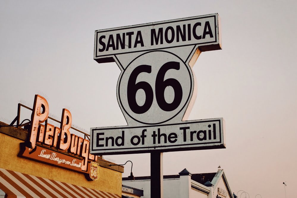
Don't be fooled by the iconic sign at Santa Monica Pier. Historic Route 66 originally ended at 7th and Broadway in downtown Los Angeles, well away from the ocean. In 1936 however, the road was extended to reach its last official conclusion about a mile from the Pacific, at the intersection of Olympic and Lincoln boulevards.
Due to the same rule that decided the eastern terminus, the Route's ending point at Lincoln Boulevard – which forms part of Highway 1 – was chosen.
So why is the edge of the Pacific Ocean the spiritual end of the road? After the Route gained its status as a tourist attraction, the Route 66 Association decided this intersection was an anticlimactic terminus for travellers on the road and mounted the "End of the Trail" sign at Santa Monica Pier.
Ready to see all Route 66 has to offer? Get in touch to join us for a guided road trip.


